pile.org
2017 E5 walk, day 0: Audierne to Plogoff
48°1′22.8″N
48°2′12.5″N
The E5 starts at the Pointe du Raz, so I consider this day getting there to have been the “zeroth day”, before the walk officially began.
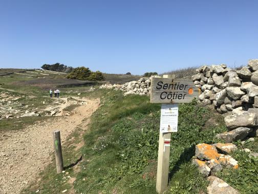
I spent the day making my way from Quimper1 to Plogoff, the village closest to the Pointe du Raz. The first stretch was a bus from Quimper to Audierne, which took perhaps an hour, and got me there in time for lunch. For the second stretch, I’d hoped to take another bus, but the line wasn’t running (it would start service for the year on the very next day). So instead I walked west along the GR 34 to Plogoff.
The GR 34 is a Grande Randonnée (roughly “great hike”) trail, one of France’s many, this one running the length of Brittany’s coast. I would be following it for the next several days, and then returning to it a month later.

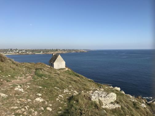
The day was gorgeous, far nicer than early April had any right to be. As I left Audierne, there were several other people out for a walk, but nobody else on a long-distance hike. Once the trail left the immediate area of Audierne, most of the walkers disappeared, and the trail followed the coast pretty closely, mostly along rugged cliffs above the Atlantic. There were fields and buildings inland from the trail, and one charming abandoned hut.

The trail passed by a small WWII memorial, to three Free France soldiers who had been ferried to the location from England, and were eventually captured and executed by the Germans. It’s one thing to have read about the European wars in history class, but entirely another thing to see memorials listing specific names of people killed.2
As the sun started sinking, I left the GR 34 and made my way inland towards the settlement of Kerguidy. Though a path was marked on the map, it was little more than a track that ran alongside a farm field; it wasn’t clear that I was supposed to be walking there.
I really didn’t know what I was doing at this point. Beyond just setting too fast of a pace (not sustainable over the course of weeks), I barely allowed myself enough time to reach my destination before dark. I did, however, set an example that held for the rest of my walk: I hadn’t made reservations at a place to stay, and it turned out that the place I’d identified online (a B&B near the cape) no longer existed (or at least I couldn’t find it). I looked for my backup option, a campsite called La Ferme du Bout du Monde (“the Farm at the End of the World”), only to find that Apple Maps had the address in a grossly inaccurate location.3 Eventually I found my way there, as dusk was falling. The owner seemed nonplussed to find an unannounced hiker, barely comprehensible, arriving late and off-season. Nevertheless, he took my information and money, and showed me to the little field where I inexpertly pitched my tent. Still restless, I walked in to town, then returned and passed out for the night.

-
I had flown in to Paris on the morning of the 6th, got a charger and a local SIM, and took a fast train to Quimper, arriving at night. ↩︎
-
Every church I passed on my long walk had a memorial to local people killed in WWI, with a smaller addendum for those killed in WWII. ↩︎
-
Google Maps quickly became my default location-finding app, as Apple’s continued to disappoint me over the course of the next few days. ↩︎