pile.org
2017 E5 walk, day 57: Perdreauville to Neauphle-le-Château
48°47′44.7″N
48°48′42.4″N
Before the kids were up, I had a quiet breakfast, and then headed out.
The trail soon entered the Forêt Domaniale de Rambouillet, and roughly followed the route of a stream. After the village of Gambaiseuil, the stream and trail entered a valley.
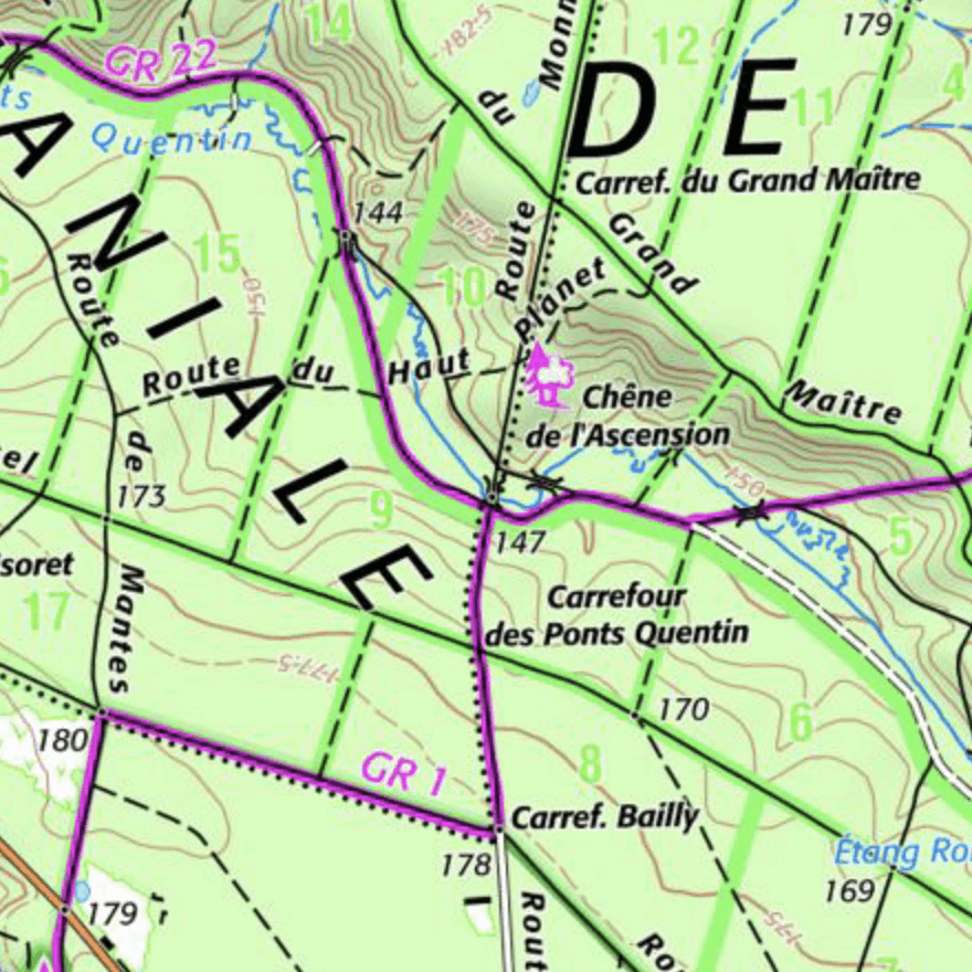
At 11 AM, I reached a T junction. The GR 22 continued to the east, while the E5 turned to follow the GR 1 to the south. I left the E5, which I had been following for 56 days, and headed east to end my walk in Paris.
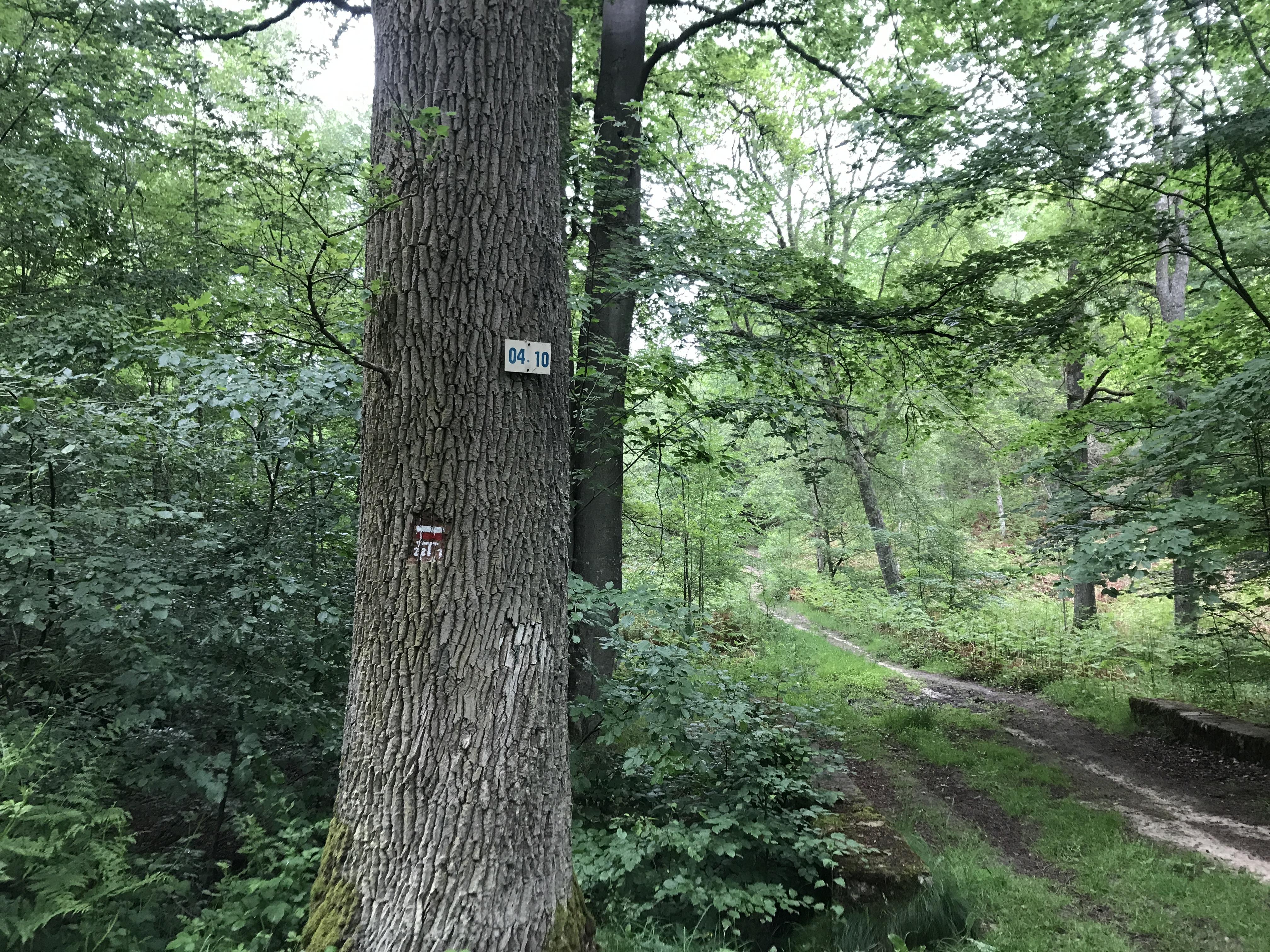
About an hour later, the trail turned north, and soon crossed a stream, the Ruisseau des Brûlins. The trail near the stream had thousands of tiny frogs, perhaps an inch long, hopping in every direction. I did my best to avoid stepping on them.
Another half hour had me exiting the woods for the day, after which I passed through a pair of towns. First was Montfort l’Amaury, a cute little town that wasn’t as fully-preserved as Dinan, but still had a touch of quaintness to it.
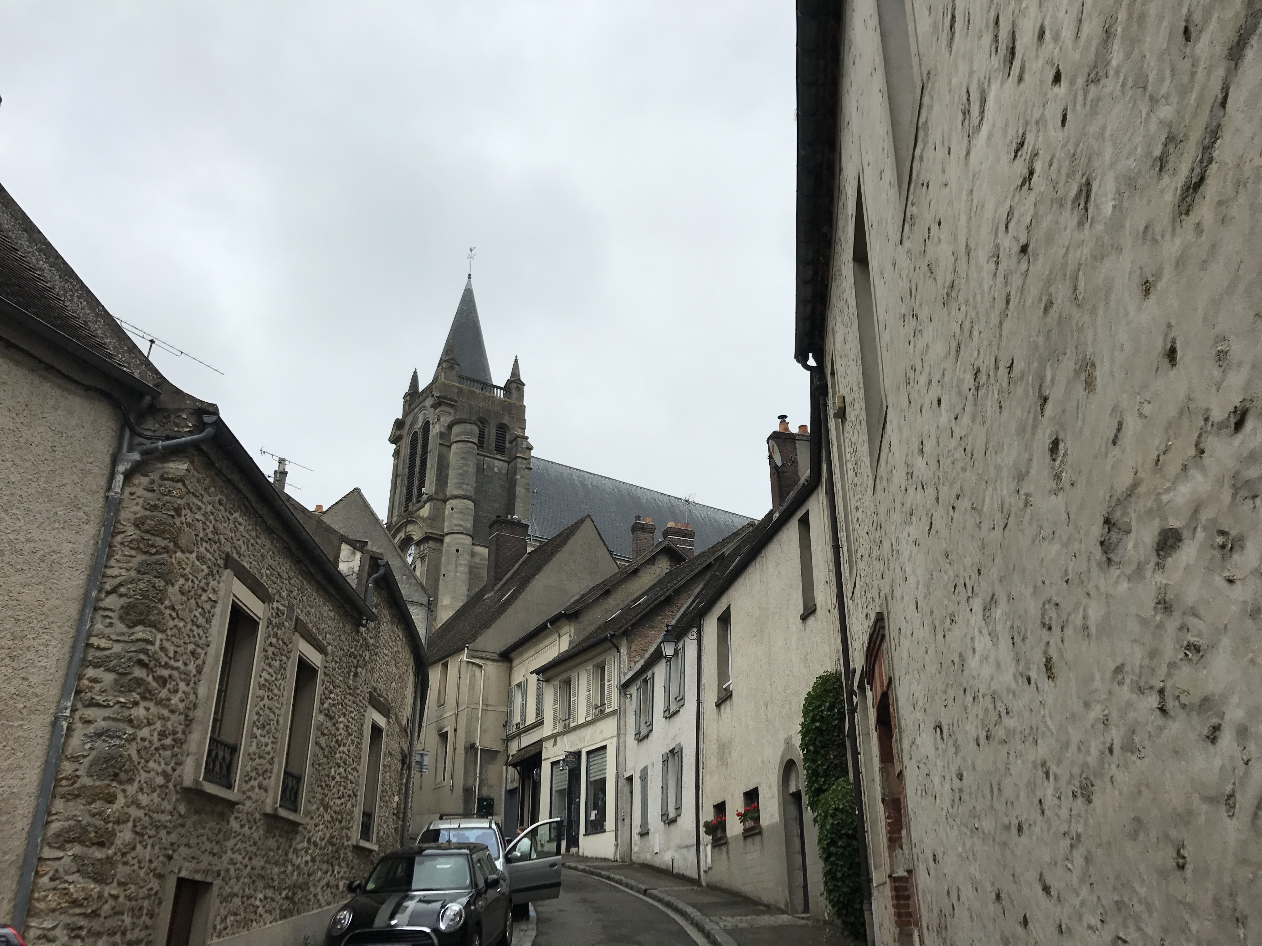
There was a castle built by Anne of Brittany on top of the hill overlooking the town, but I didn’t feel energetic enough to climb up to see it. Instead, I got some macarons from a boulangerie as I headed out of town.
From Montfort, the trail passed through the town of Méré, and then across fields and over a highway to the village of Neauphle-le-Vieux1, with the GR 11 re-joining the GR 22 along the way. From there, the trail took me through the adjacent town of Villiers-Saint-Frédéric (the GR 1 splitting off again2), and into Neauphle-le-Château, my destination for the evening.
I left the trail at the town square, and made my way to the AirBnB. After first knocking at the wrong house, I found the correct one, and met the very gracious owners.
For dinner, I made my way back up to the town square, and ate at Le Valinco, an Italian restaurant. After dinner, I wandered the nearby streets.

-
I don’t know what the right term for this place is — on the map, it’s the size of other places I’ve called villages, but it’s also a continuous part of the developed area that includes Neauphle-le-Château. ↩︎
-
Many trails go near or into Paris, and there is only a limited number of viable routes for them to take, so by this point they were merging and branching frequently. ↩︎