pile.org
2017 E5 walk, day 16: Gouarec to Beau Rivage
48°13′36.8″N
48°12′38.8″N
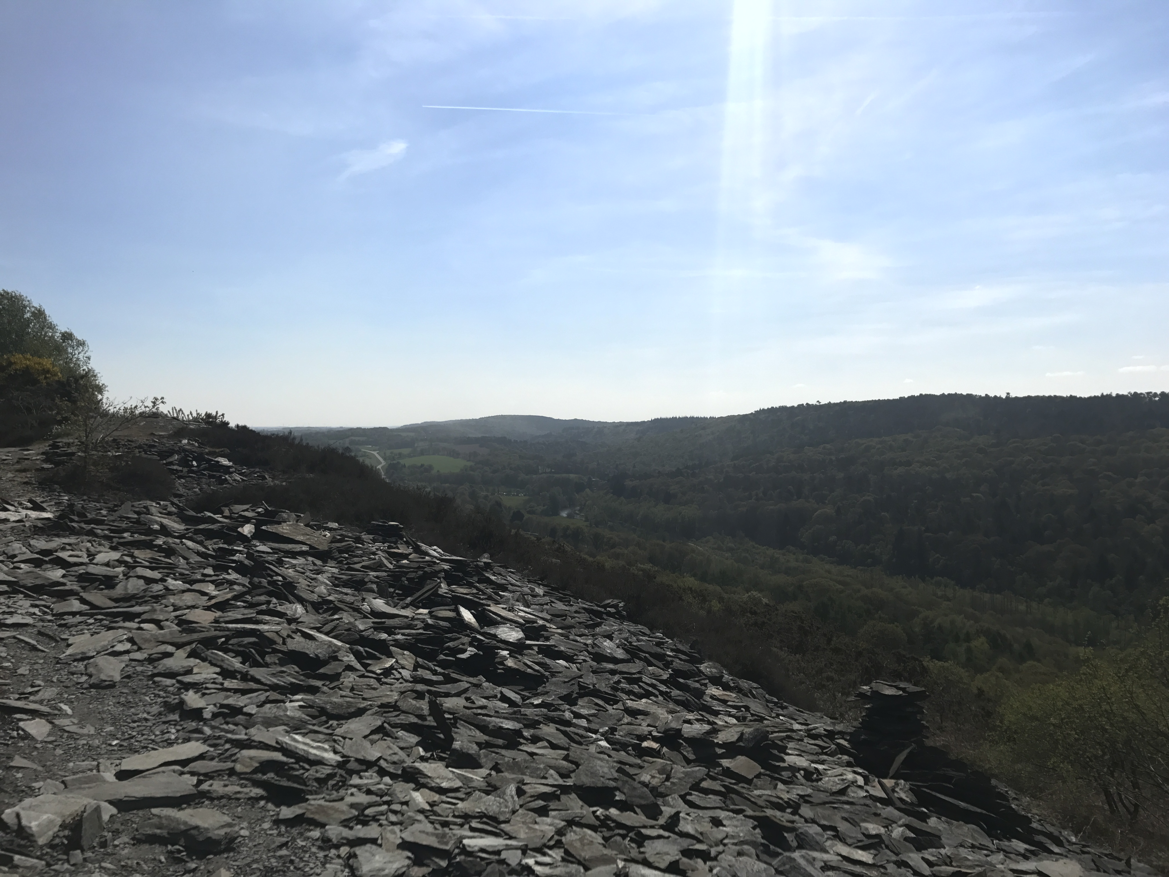
The trail climbed steeply as I left Gouarec, dove back down to canal-level, and then steeply back up again to run along a ridge covered with slate. This day turned out to be the most climbing I did (as measured by my phone) for the entire walk.
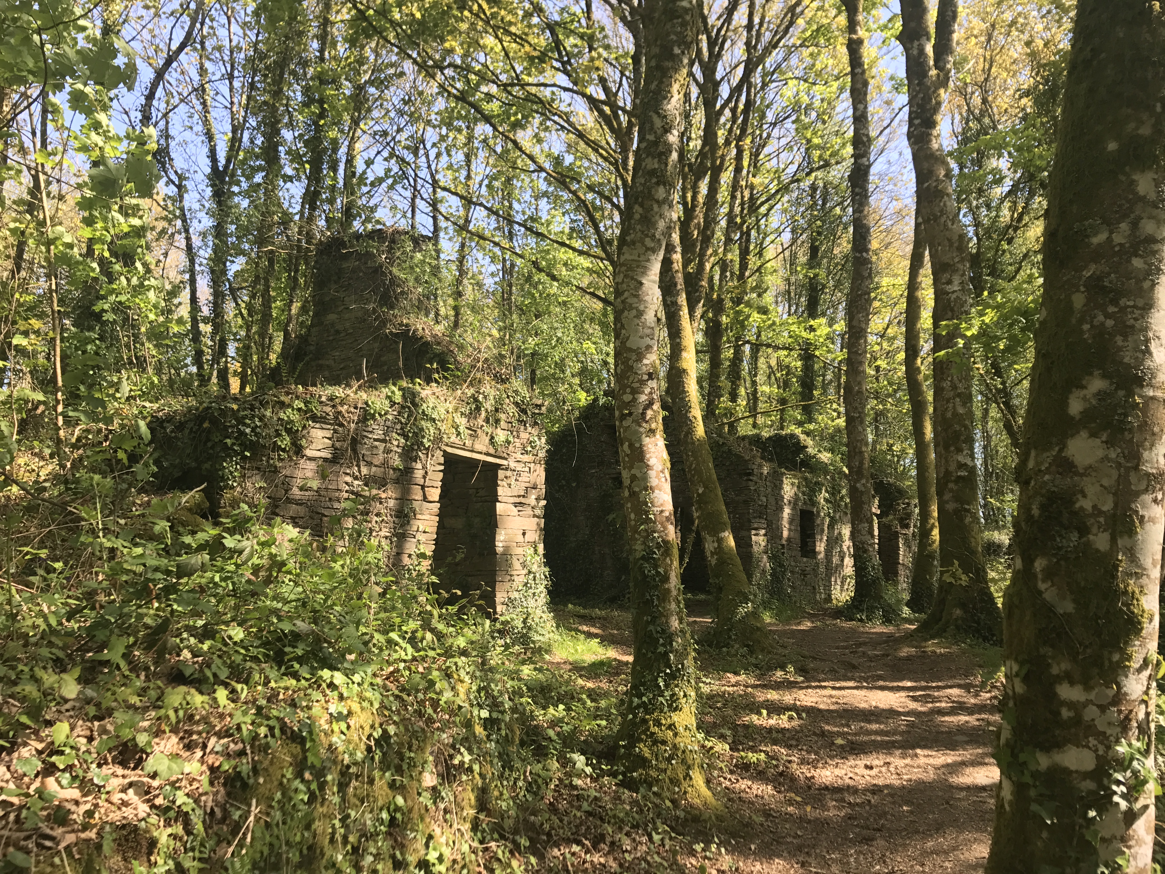
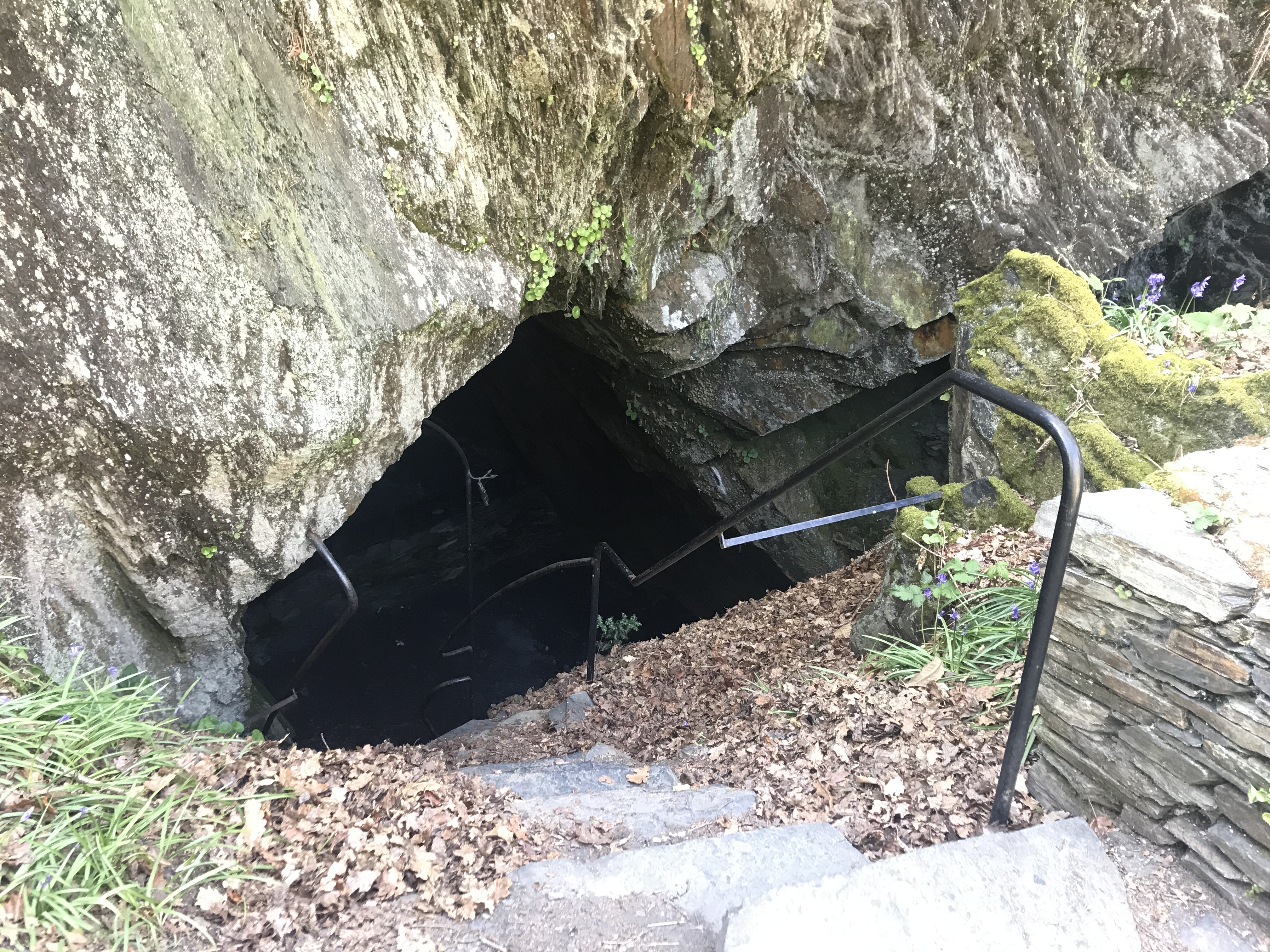
The trail passed several ruined huts, made of stacks of thin slabs that looked suspiciously like slate. The story I told myself is that these huts belonged to slate miners, back in the day.
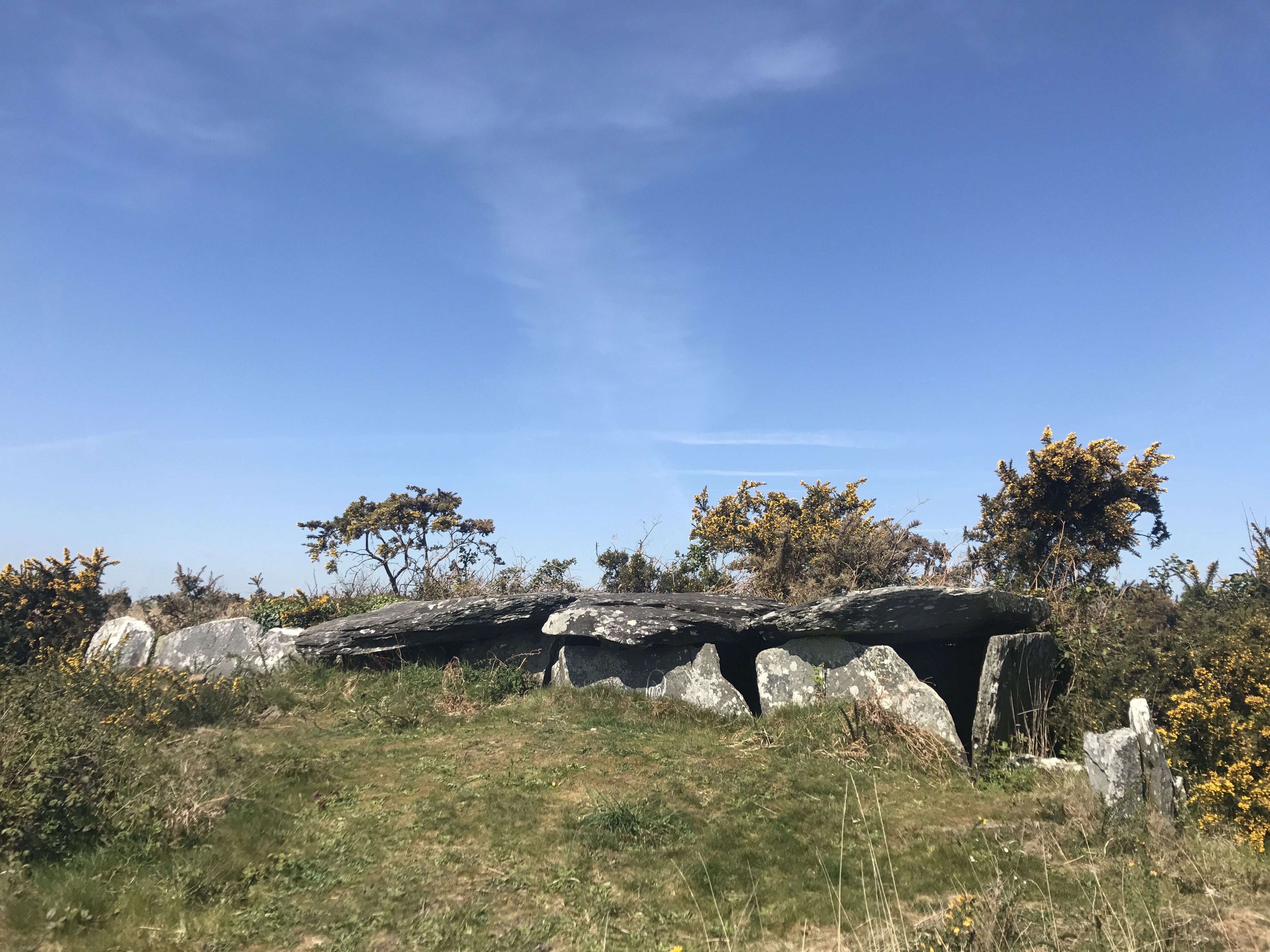
Further along the ridge, the trail passed several prehistoric barrows, from somewhere around 4000–2000 BCE. In French, they are allée couverte (literally “covered alley”); the English term is apparently “gallery grave”.
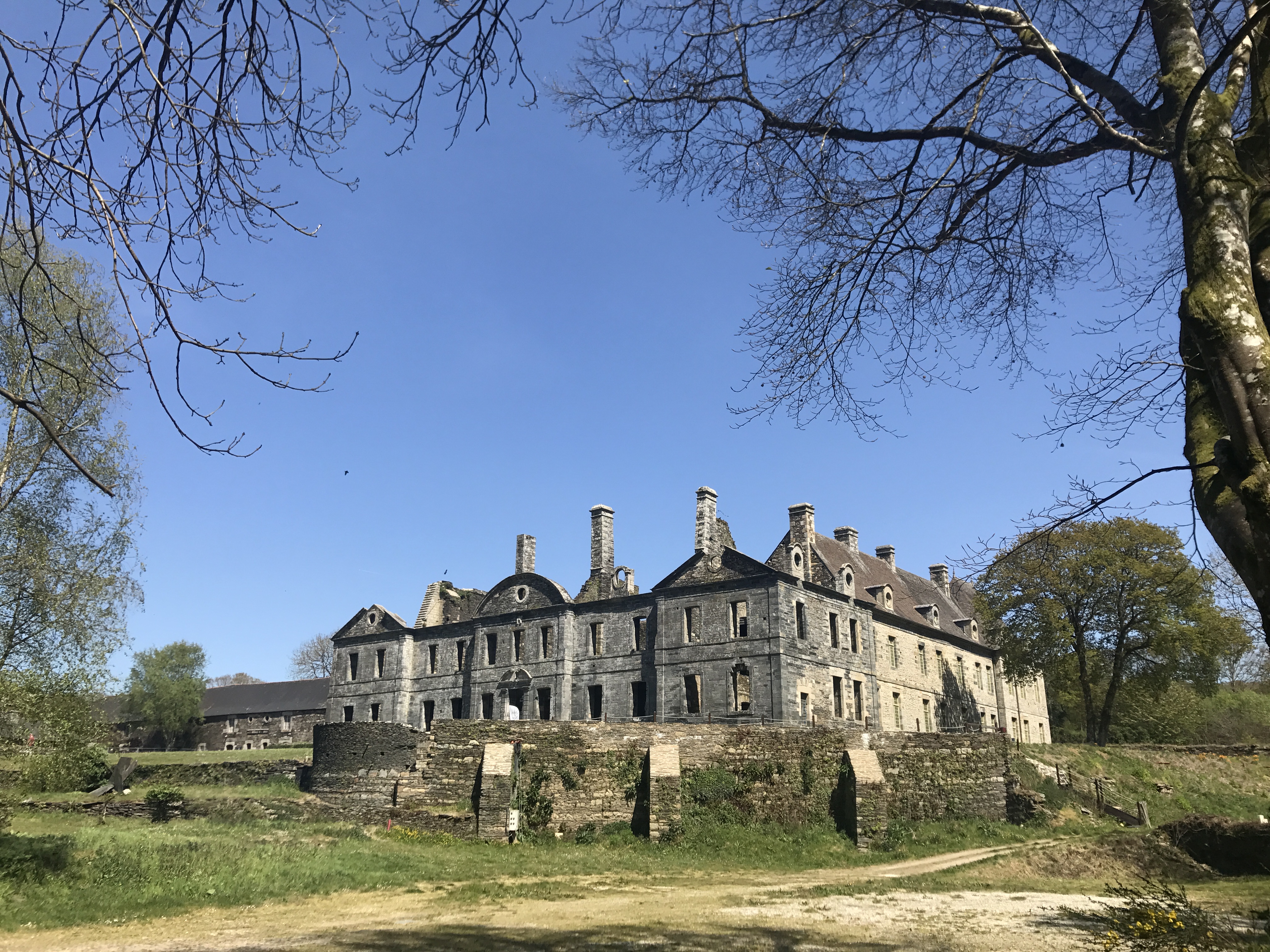
Just to the east of the barrows, the trail forked. The best information I had was that the E5 left the GR 37 at this point, to follow the GR 341 for several days. The GR 341 wound down into a pretty gorge, before climbing up and then descending to the ruined Abbaye de Bon-Repos. (I ate a crêpe at the nearby gift shop.)
At the abbey, the trail returned to the canal. The canal soon became the artificial Lac de Guerlédan, at which point the trail became difficult. The problem, I think, is that the trail hadn’t grown organically over hundreds of years of use. Instead, it ran more or less along the shore of the lake, which (being new and artificial) didn’t have an especially graceful shoreline. So the trail climbed up and down over the folds of the land, fairly relentlessly. This, at least as much as the slate ridge at the start of the day, contributed to the day’s record climbing.
I topped up my water at the little resort-like village of Beau Rivage, then headed inland to Camping du Lac. Of course I hadn’t called ahead, but the manager (I believe from Italy) let me in through the gate, and I found a small spot suitable for my tent.
