pile.org

2017 E5 walk, day 30: Dinan to le Minihic-sur-Rance

Section 7, Day 30
Dinan
2°1′57.7″W
48°27′41.7″N
Le Minihic-sur-Rance
2°0′11.8″W
48°34′37.8″N
low 44 °F
0.02″ rain
high 61 °F
41,318 steps
16.1 miles

The day’s walk was relatively un­e­vent­ful, following the GR 34C north down the Rance. Almost immediately downstream from Dinan, the Rance widened and began meandering a little more.

A wide river runs from the near right corner of the photo to the far left.  Its far shore appears low and muddy, with tree-covered cliffs immediately beyond.  In the foreground, a trail beaten into the grass leads away, following the river.  Below the trail are two decrepit-looking wooden shacks on stilts above the river, connected to the land at the height of the trail by decrepit-looking wooden walkways.  In the distance, to the east-northeast, a sturdy stone or concrete bridge arches over the river.  The sky is overcast.
The bridge ahead was for trains, but more interesting are these structures in the foreground — maybe shelters for fishing?

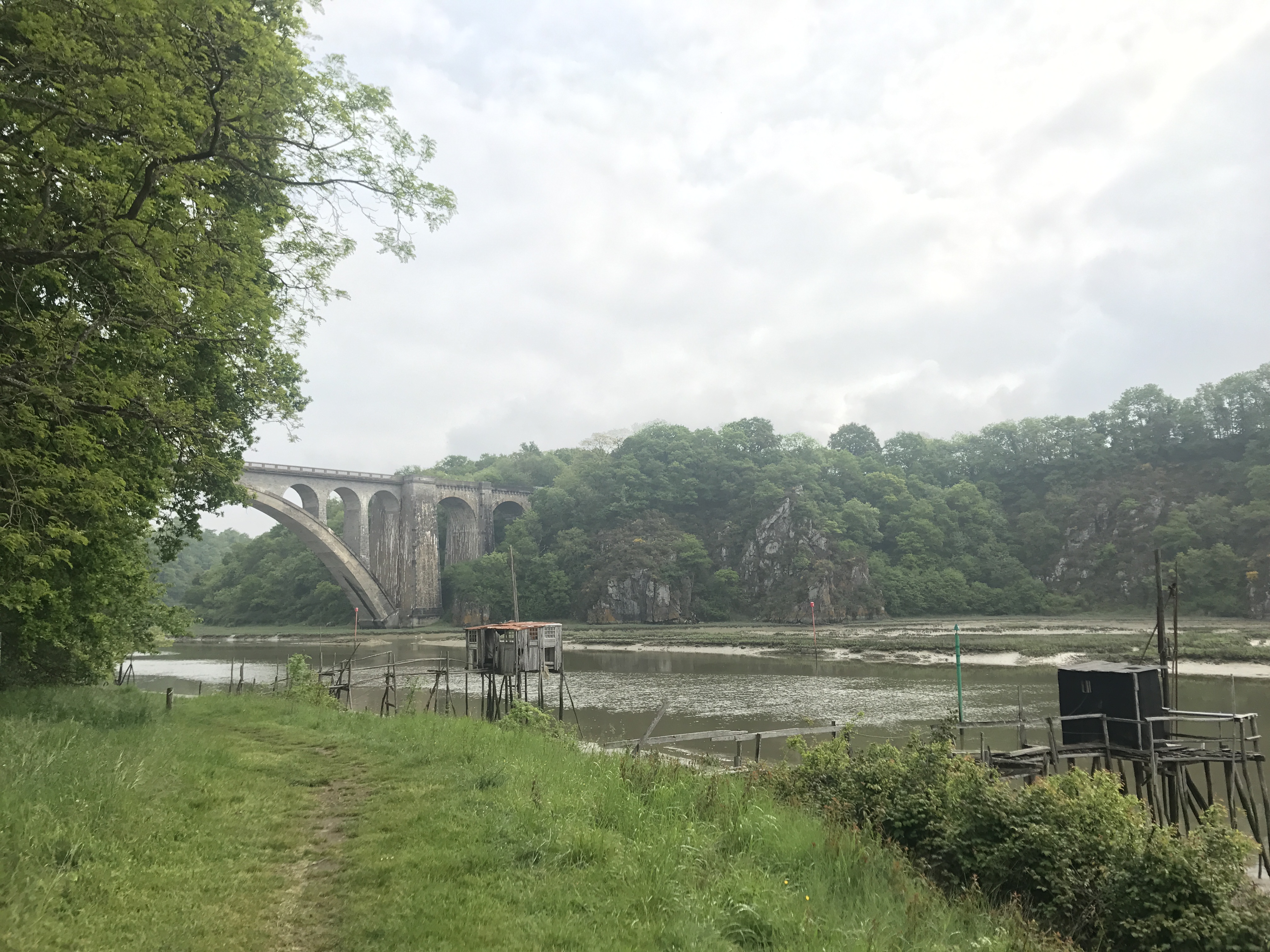
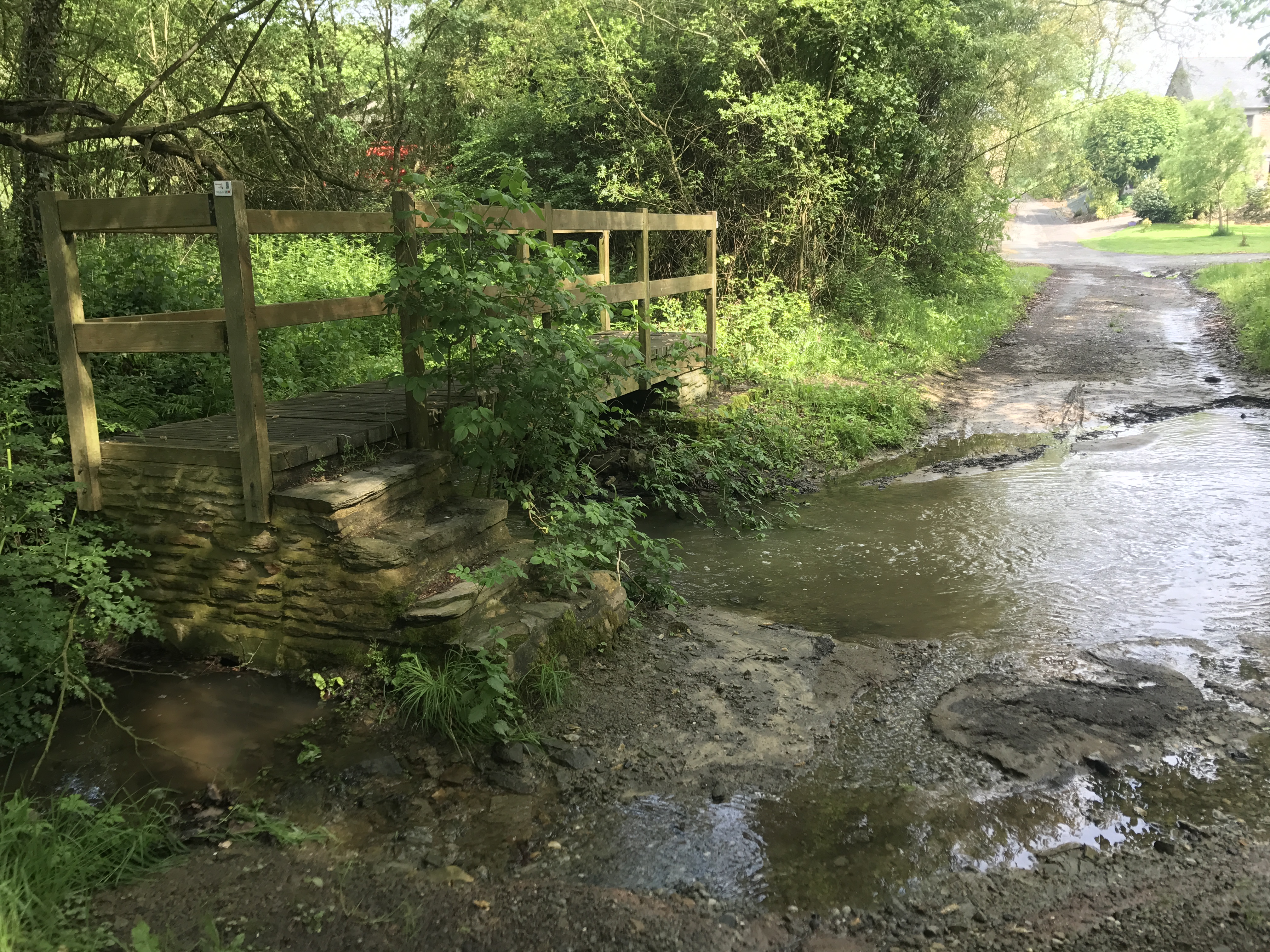
The trail was right alongside the Rance for most of the day, though it occasionally veered inland, to cross a stream or perhaps avoid a rocky promontory.

A one-lane paved road runs to the north, broken by a creek.  It looks like it could be a temporary flood, but there is a footbridge that crosses it to the left, by the side of the road:  stone stairs leading up to a well-built wooden bridge, with stone stairs down on the far side.  The road and bridge are shaded by tall trees; buildings are barely visible ahead.
Here, the trail swung inland a bit, and crossed the Ruisseau de Coutance (“Coutance Creek”) along this road. I love how vehicles don’t get a bridge — if the stream is running especially high, they could just drive a quarter mile upstream to the next crossing — but pedestrians get this charming footbridge.

The biggest such detour was around the town of le Port Saint-Hubert, where the riverside was very steep and a highway crossed the river.

A mud flat stretches to the east to a faintly-visible river.  On the near side is a small sailboat, for one or perhaps two people, tilted at a 30–45° angle on the mud.  In the mud are long, curved mounds of higher mud; it looks like a stream might have carved channels on its way to the river.  The far side of the mud has trees; the near sky is clear, though there are clouds in the distance.
Shortly before the town of Langrolay-sur-Rance, an unnamed stream emptied into the river and left this fascinating maze of channels (with somebody’s boat alongside).

My destination was in the town of le Minihic-sur-Rance: a gîte that was effectively a large bedroom with several beds for guests, on the upper floor of the home. It was election day, and when I arrived, Chantal, the owner, was heading out to vote. When she returned, we talked politics for a while; she was very anxious about the election and the prospect of a right-wing president, which I could sympathize with.1

I cooked my simple dinner of pasta with cheese and salami. Chantal commented on its austerity, and I’m now reminded of a bit from Craig Mod’s article about his own long walk in Japan:

About a week into the walk, I told an old woman about my schedule and she asked me, “Is this an ascetic practice?” I laughed in the moment, but then for weeks as I walked, I turned her question over and over in my mind.

Late in the evening, an old friend of Chantal’s arrived from a writer’s retreat in a lighthouse in the west of Brittany (possibly the résidence d’écrivain d’Ouessant?). Of course, I was on my American/walker’s hours, and so turned in early while they stayed up late to catch up.

Map of the day’s route.

  1. A running sub-theme of this trip was people basically asking me “what the hell happened over there?”, and me apologizing on behalf of the country. ↩︎