pile.org
2017 E5 walk, day 24: La Ville ès Mélais to Beignon
48°3′5.0″N
47°58′42.3″N
I left the house before most people were up, and crossed east under the highway towards the Forêt de Paimpont, perhaps more widely known as the Brocéliande, which shows up in several parts of Arthurian legend.
There’s a lot of mystical woo-woo in the tourist information about the Brocéliande. The forest was interesting in places, but from what I saw at least, I’m not sure it was quite all that.
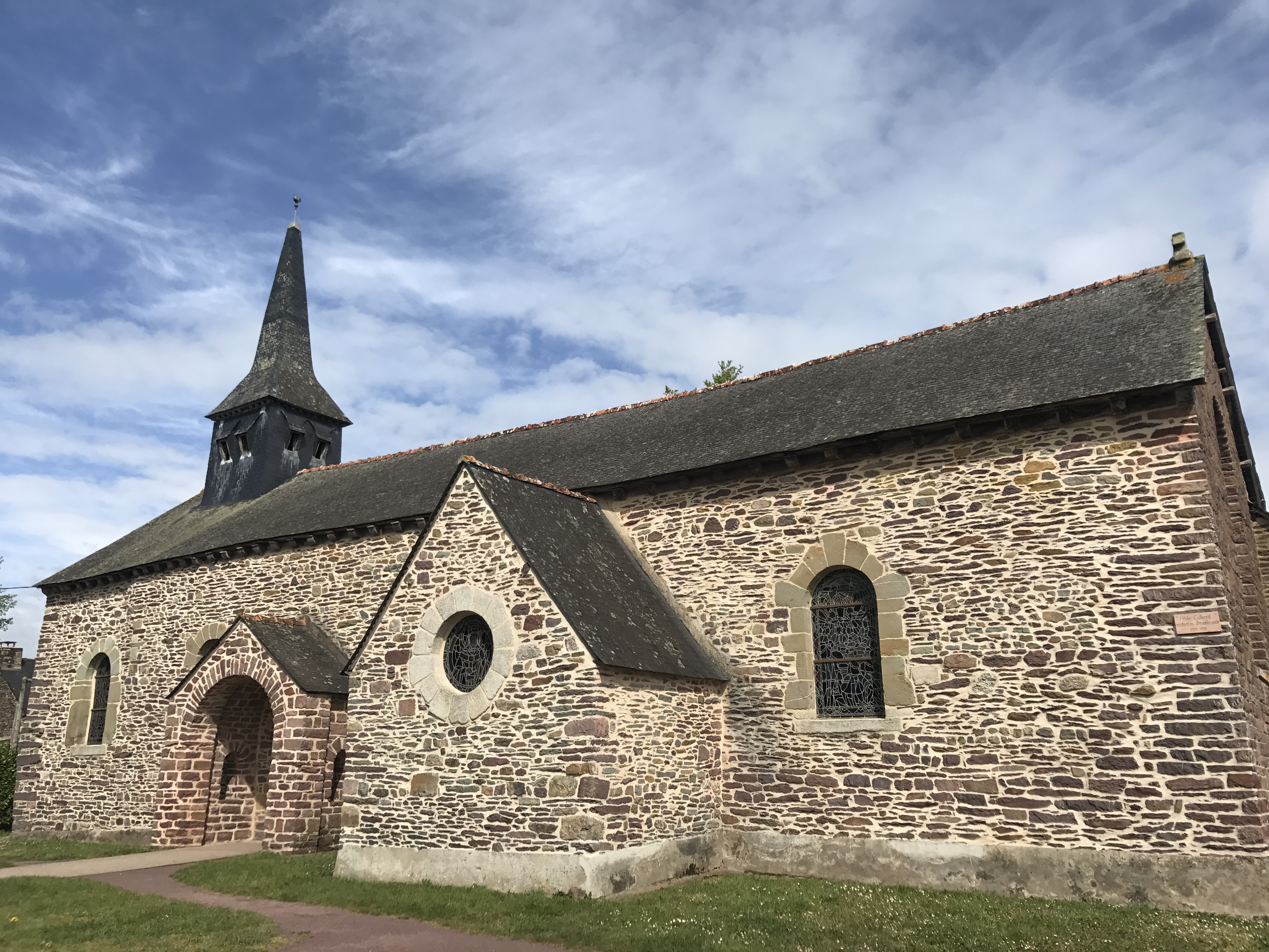
Partway through the forest, the trail came out into a clearing and the village of Tréhorenteuc. Its tourist draw seems to be the Église du Graal, a church themed around the Holy Grail. There were quite a few other tourists and day walkers around — perhaps the most people I’d seen in one place, outside of a town, on the whole trip. Since it was Labor Day, though, the village’s crêperie was closed.
After leaving town, the trail climbed up a rocky hill; as I reached the top and assembled a sandwich, it started to rain. The trail then descended back down into the woods for one last bit of touristiness before settling down for the rest of the day.
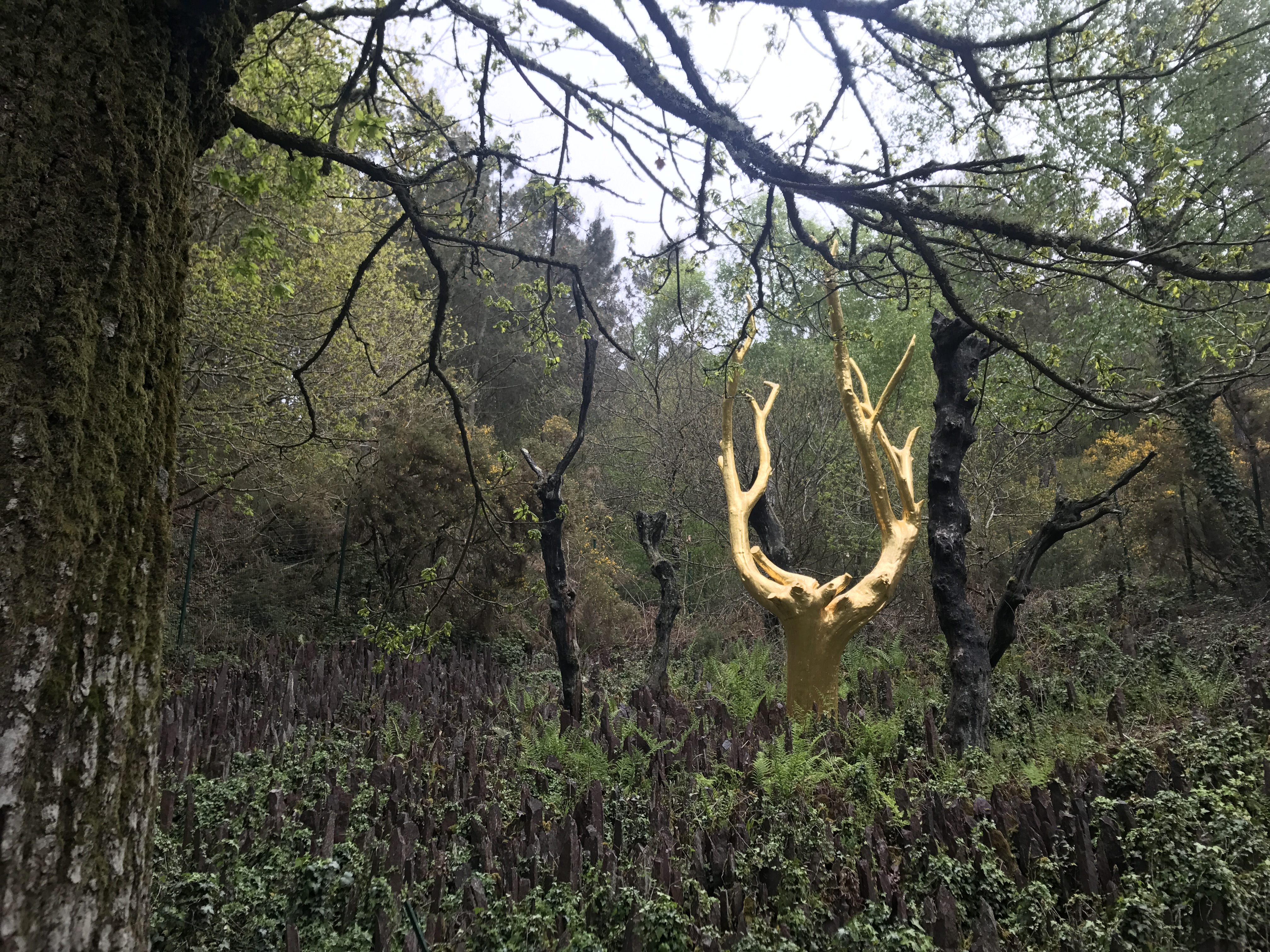
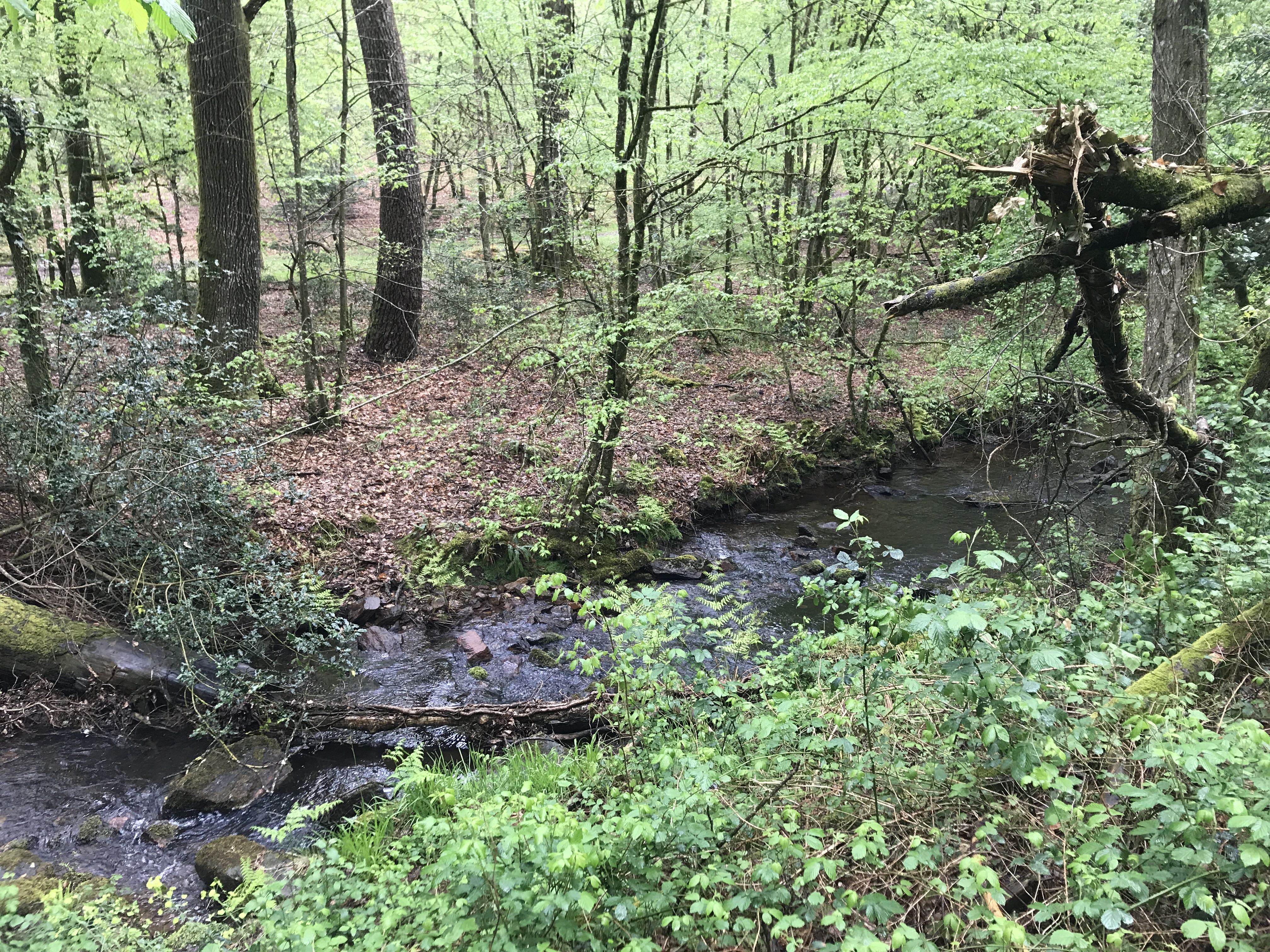
Right by the golden tree was a pond called le Miroir aux Fées (“Mirror of Faeries”), as the trail entered le Val sans Retour (“the Valley of No Return”, cue ominous music).1 But this part of the forest in the south was actually quite pleasant. There were many streams and little rivers that I crossed during the afternoon, and even the occasional showers didn’t feel unwelcome.

There was one point where the trail seemed to climb another rocky outcropping, but I lost track of the markings, so I’m not certain I was still on it. I found more markings once I descended again, after maybe ten minutes, so I can’t have been too far lost.
For the last part of the day, the trail kept the river Aff on its left. On the right was the border of a military camp and school (Camp de Coëtquidan), with stern and ominous warnings of danger and death if I wandered into the area.
Just past the town of Beignon, I left the trail and headed south to my campsite for the night, at the edge of the neighboring town of St-Malo-de-Beignon. The first part of the walk was along a narrow, winding road, which was a little uncomfortable, but a small walking trail branched off soon enough.
When I arrived at Camping d’Aleth, there was no attendant, but I phoned to let them know I had arrived, and set up my tent. A pleasant woman eventually showed up to take my money, with a tiny, hyperactive dog in tow.
The campsite was themed, and the theme seemed to be “1860s America”, complete with tipi-style buildings, a caricatured carving of a native American, and a Confederate flag. It was, frankly, a little nauseating; it was the kind of casual, thoughtless racism that felt like it was unchanged since the 1950s. My French wasn’t good enough to explain why this wouldn’t be acceptable in the United States;2 the best French equivalent I could think of was if Vichy France had a distinct flag, which was flying alongside a reproduction of a stereotypical Romani caravan.3 Frustrated, I bit my tongue, cooked a simple pasta dinner, and stayed the night.

-
To be fair, I did not actually return, since I went all the way through and never returned to Tréhorenteuc or the tree or the pond. ↩︎
-
I’m sticking with “in the United States”, though I realize I may live in a somewhat more sensitive corner of the country. ↩︎
-
And maybe that wouldn’t strike a lot of French people as being problematic. ↩︎