pile.org

2017 E5 walk, day 33: Pointe du Grouin to Mont-Dol

Section 8, Day 33
Pointe du Grouin
1°50′43.8″W
48°42′15.5″N
Mont-Dol
1°46′4.3″W
48°34′8.3″N
low 42 °F
high 70 °F
42,007 steps
15.7 miles

I left the campsite by the gate I entered, directly onto the trail. It wound along the cliffs, occasionally dropping down to a small cove or such, heading basically south to the town of Cancale.

Looking down at a roughly-paved trail, the photographer’s left shoe is visible at the bottom of the photo.  A small bird is standing on the trail perhaps one foot in front of the shoe, approximately the size of a tennis ball, with dark grey-brown with a barely-visible bright orange breast.  A pair of trekking poles leans against a wire fence on the left, beyond which is a brush-covered downwards slope.  On the right, the trail is interrupted by a rock or perhaps concrete.
Immediately around the first bend from the campsite, there was yet another German bunker. Instead of a picture of that, here’s a picture of a European robin right next to it.

I stopped in Cancale for some bureaucracy: At this point, my plan was still to walk the entire length of the E5, so I needed a long-stay visa (as opposed to the simple 90-day visas that are granted without fuss to tourists). I needed to make some photocopies and drop off some paperwork at the post office; alas, the library, my go-to photocopy site, wasn’t open, so I went to the presse (a small newspaper/magazine/book shop) instead. I stopped in the main plaza for groceries, and then for bread and pastries at le Fournil de Cyrille, before returning to the trail.

Below to the east is the ocean shore.  Perhaps in the tidal zone are structures, various rectangular shapes, partially submerged in the water; it’s hard to tell, but they might range from 5–40′ wide.  A few thin clouds are visible in the sky, along with three gulls; a corner of a parking lot is visible down at shore level, and brush growing on the slope up to the viewpoint interrupts the bottom of the photo.
Just a little farther south along the trail, these are part of Cancale’s famed shellfish production.

South of Cancale, the trail soon dropped down to the shore1 and stayed there for most of the rest of the day. It passed along the waterfronts of a small town, Saint-Benoit-des-Ondes, where I bought an Orangina as a rare treat (the day was warm), and various little villages and clusters of buildings.

A beaten-dirt trail winds east through ground cover towards tall grasses and then a distant beach.  The total change in elevation visible in this photo is something like one foot up or down.  The sky is clear blue, with haze visible at the horizon.
It was so flat for this stretch of the trail that I briefly thought about what a tsunami would be like (not that there are any in this part of the world). (It would probably completely devastate the area.)

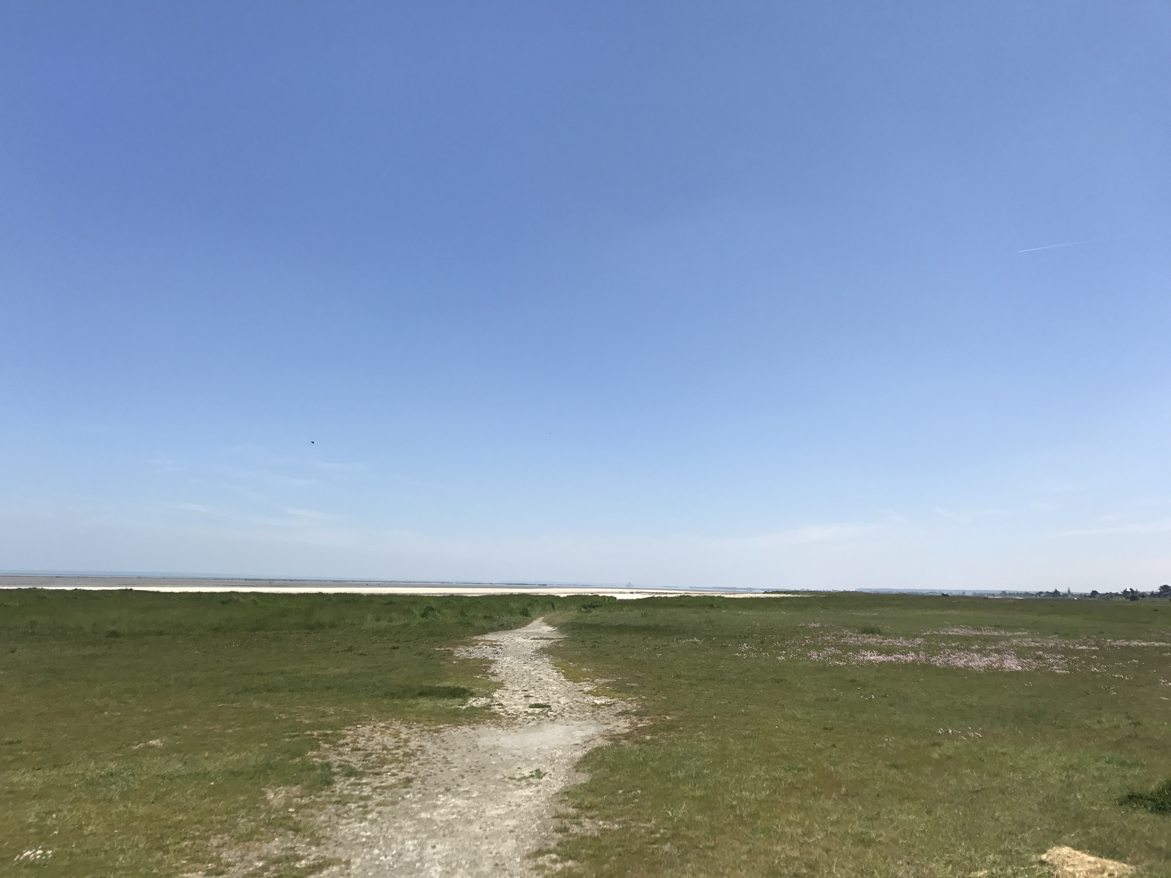
Shortly after the village of Hirel, the trail turned inland towards the towering spire of Mont Dol, in whose shadow I planned to camp for the night.

Beyond a green field to the southeast, a tree-covered hill is the only topographical feature; it spans perhaps a third of the width of the photo.  A few trees suggest a line from the left of the photo towards the hill, perhaps pointing out a trail.  The sky is blue, with wispy clouds.
Mont Dol dominated the skyline for almost a mile in every direction, soaring more than 200′ into the air. Apparently the archangel Michael fought the Devil here, though I didn’t know that when I climbed it.

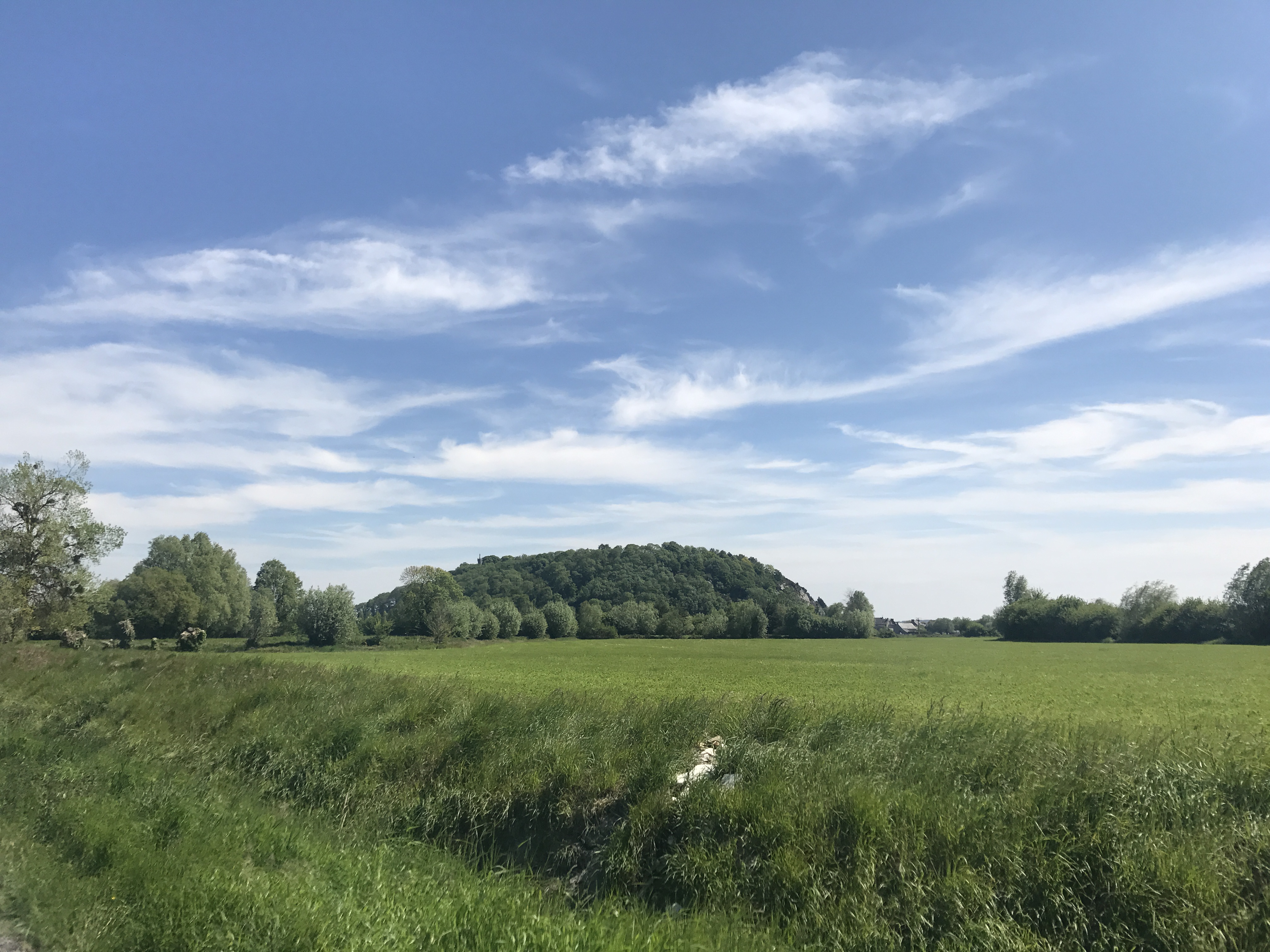
Mont Dol was a steep but brief climb, with what was, sincerely, an amazing view from the top.

At the top of a hill, a round stone windmill in good repair is to the southeast.  The blades on the right are only frames, with no canvas to actually catch the wind, but it looks in good repair otherwise.  On the left (back) of the mill, some kind of beam stretches diagonally from the base of the conical roof to the ground; perhaps it is a chute for milled grain.  A wooden fence is at the left of the photo, and trees are scattered around the far side of the mill.  A small calvaire (crucifix) stands in front of the mill’s blades.  The sky is blue with scattered wispy clouds.
Mont Dol also had this lovely old windmill, I think the Moulin du Tertre, at the top.

Down the other side of the hill, I left the trail and wound around to the east side, through the imaginatively-named village of Mont-Dol, to Camping au Mont-Dol. There, with donkeys in the nearby field, I slept well.

Map of the day’s route.

  1. Along the shore south of Cancale, there were several restaurants and stands selling oysters, a local specialty. I’m allergic to crustaceans, but knowing I’d be passing through this area that specializes in mollusks, I got tested before I left (eating a small bowl of mussels while at the allergist’s office, EpiPen at the ready), and found I wasn’t allergic. And then I got to Cancale and … they just didn’t sound appealing. Sorry, Cancale; maybe I’ll try your oysters next time. ↩︎